
Fellow Science Lovers,
Dylan here. I’m finally releasing my first newsletter. Each month, I plan to share a different piece of research I did to support one of my novels. These explanations are so nerdy and detailed, I couldn’t fit them into the actual book.
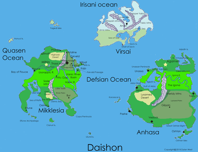
First up is how I make world maps. I’ve made 5 of them for the Scribeverse, so I’m starting to settle on a process. Here’s Daishon, the world that Scribes’ Descent takes place on:
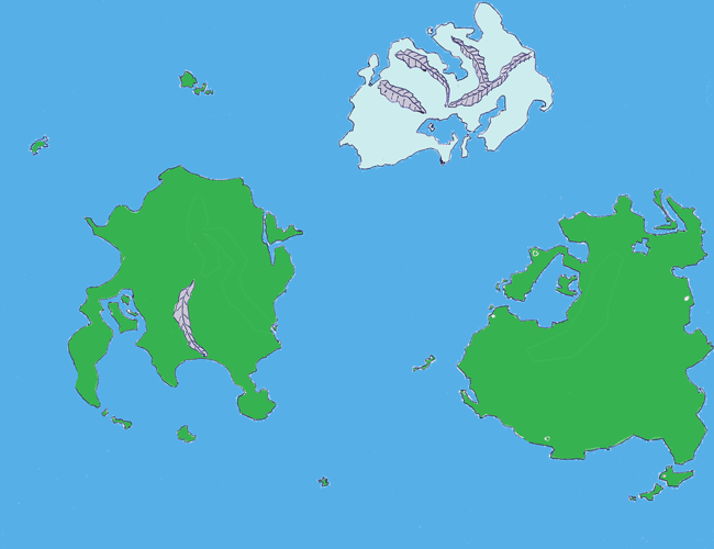
I start with a penciled hand sketch on unlined paper. Then I ink it in, scan, upload to my computer, and open it in Photoshop. There, I use the paint bucket tool to add base colors to the landmasses and ocean on the bottom layer:
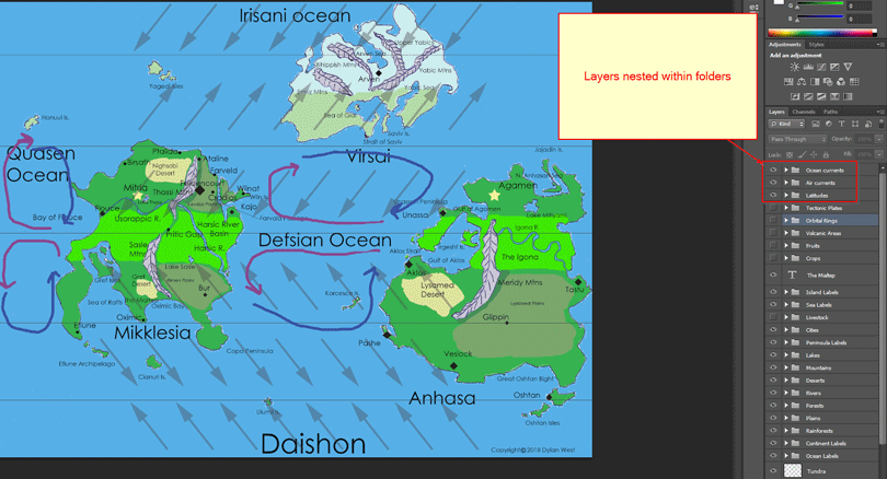
Then I paint in the different types of geographic detail on separate layers. That way I can toggle visibility as needed. Here, I show the prevailing winds, major ocean currents, and lines of latitude:
I follow these steps:
- Ensure the lands fall on suitable lines of latitude for the climate those areas need. For Scribes’ Descent, Mallory’s hometown of Feldencourt has a moderate climate that supports fertile plains. On this map, it lies roughly along the same latitude as Virginia.
- Draw the prevailing winds. I base this off of the ones on Earth. Now that means Daishon must be roughly the same size and rotational speed as Earth. If it were more the size of Jupiter and spun as quickly, I’d have to draw many more than just 6 bands of prevailing winds.
- Draw the major oceanic currents.
- Draw the tectonic plate outlines. Roughly align these with the various continents and wherever you know you’ll need mountain ranges.
- Place mountain ranges accordingly.
- Based on the direction of prevailing winds, proximity to the tropic latitudes (Tropic of Cancer and Capricorn), and placement of mountain ranges, draw in the rain shadow deserts.
- Place the major rain forests. These should fall along the equator and form in basins beside a major mountain range where all the rainwater collects into thousands of streams that convert into one giant river.
- Draw the major rivers, lakes, icelands, and fertile plains.
- Place the major cities. When placing the story locations, think of the climate best suited for the events that happen there and place them accordingly. Also consider travel time between places.
- Name all the relevant features, such as cities, mountains, deserts, rivers, islands, continents, and oceans. Those are the obvious features, anyway. For added realism, you can also label the less-obvious ones, like peninsulas, straits, bays, national parks, volcanoes, archipelagos, and canals. You can even designate some deserts as being cold deserts. When placing volcanoes, keep them along the borders of the tectonic plates you drew in step 4.
- Place icons for where the major staple crops grow and where the large domesticable mammals are found. If you’ve read the book Guns, Germs, and Steel, you’ll know why that’s important 🙂 I’ll write a separate article on how that book has helped me develop maps and historical timelines for my planets.
- Time to get political! Colorize territories across the landmasses. You may have kingdoms, countries, tribes, or nation-states, or some mix of them all. Consider which territory ends up with which geographic features and how this might drive conflict among them. You might even draw in linguistic regions to show which languages are spoken where.
Whew! That’s a lot of work, and much of that won’t end up on the final map included in the actual book. But I find it helpful for realism. In the early chapters of Scribes’ Descent, I send Mallory up to an orbital habitat that remains stationary above the continent of Virsai. Before I wrote that scene, I drew out the orbital rings and habitats above Daishon:
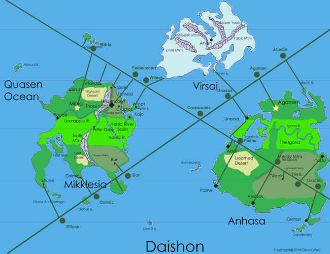
In chapter 10, Mallory and Leah compete in the Virsai Spy contest in the Wilnat orbital habitat. In the image above, you can see the dark green line that leads from the city of Wilnat up to the habitat that’s right between Mikklesia and Virsai. Knowing these location details helped me plan out how far and how long their magnetic train ride would last.
I could say much more about this map, but I’ll save that for another post.
Writing update: I’m 47,000 words into draft 1 of The Sewer Lord.
See you next month!
Dylan West
This is so cool! Thanks for sharing!
Thank you for reading and commenting!
This is a lot of work but you’ve done well suggestion and know how. I enjoy your imagination and discussion. You should also think about flags my boss at work has flags all in his office.
Thanks, Sherry! I developed two logos/emblems (which do show up banners and merchandise) in Scribes’ Descent. Let’s see if you can find them!